


 Hawthorne ordanance disposal movie (58M mp4)


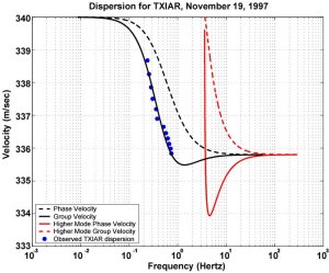 "On Infrasound Waveguides and Dispersion" (*.pdf)
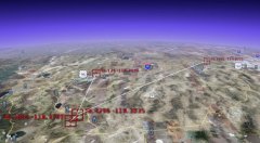 Infrasound Case Studies (2.4M ppt) Power Point Slides from Paul Golden's presentation at the 2008 Infrasound Technology Workshop.
 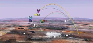 High Altitude Infrasound Calibration Experiments (4 Meg pdf) An obstacle to refining our knowledge of infrasound propagation and improving source location techniques has been the lack of sources with known yield, location, and time. To improve understanding of the most pressing research issues, a calibration experiment was organized involving six rockets, each carrying a small payload of chemical explosives.
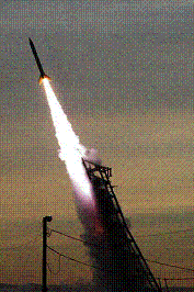 Explosions in the Stratosphere. A series of controlled high-altitude explosions of sounding
rockets launched from the White Sands Missle Range produce a truly unique infrasound dataset.
The primary goal of the project is to improve understanding of the fundamental physics of the generation of infrasound from explosions and the atmospheric dynamics affecting propagation of infrasound signals. Results indicate that the phase of an infrasound signal can be strongly distorted by short-term (hours) dynamics of the atmosphere.
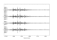 Infrasound Signals from the Re-entry and
Explosion of the Space Shuttle Columbia, 01 February 2003. The infrasonic acoustic sensors at the
NVAR array in Nevada and the TXAR array in south Texas recorded the N-waves (sonic booms) and subsequent
disintegration of the space shuttle as it passed over Neveda, New Mexico, and North Texas. The timing and
location of these events are calculated from the azimuths and arrival times of the signals.
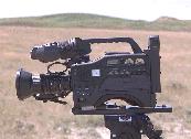 Synchronization of Video with Seismic and Acoustic Data using GPS
A technique for recording GPS timing signals on video tape for correlation with seismic and acoustic data sets. This paper is also available as an
MS Word Document (1.5 Meg).
 Bulk Mining Shot mpeg (1.7M)
200 Hz Broadband and Hi-pass Acoustic Signal.
Waveforms are time aligned with GPS synchronized video for broadband
and high-pass filtered signals. Time stamps display UTC and elapsed time for the blast. The video
has been de-interlaced to produce a slow motion (1/2 speed) display with a resolution of 16.667
milliseconds per frame.
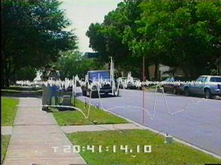 Passing Cars mpeg (2.4M)
Broadband and Hi-Pass Signals
with time aligned GPS-synchronized video, illustrating pressure wave as vehicles pass
the two acoustic sensors located about 20 feet apart on the grass between curb and sidewalk.
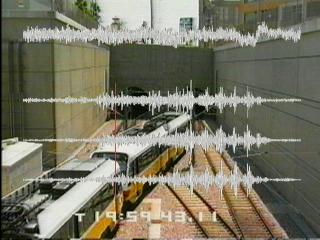 Train Entering Tunnel mpeg (6.6m) Broadband Acoustic and Seismic Signals
with time aligned GPS-synchronized video. Acoustic pressure gauges are placed along the
side and above the tunnel entrance, and seismometers are placed on the wall directly above the
tunnel. The broadband acoustic waveform is displayed at the top of the image with the three-axis
seismic signals beneath.

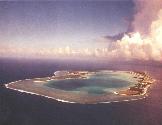 Infrasound Site Survey Site selection survey for Peale and Wake Island
infrasound installations, local geology, array design, array response, and recommendations:
Paul Golden and
Eugene Herrin.
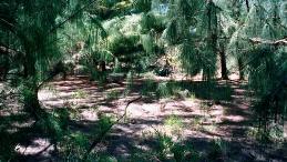 Noise Survey for Wake Island: methodology, data acquisition equipment,
data processing technique,
micropressure data, meteorological data, instantaneous wind speed, recommendations, and PTS response.

 Seattle Q1 Infrasound Microphone (541k)
 Chaparral Microphone Upgrade (534k)
 Seismo Acoustic Install (218k)
 Ft Hancock Installation (5.2M)
 Copper Mine Install (1.4M)
 Tucson Install (8.2M)
 WUAZ Install (9M)
SMU Geological Sciences Archive